Long-Range Multirotor Drone for 3D Mapping

BLAZER III and BLAZER III Pro drones are designed for 3D mapping and tasks that require a stable platform and flight time up to 40-50 min. 

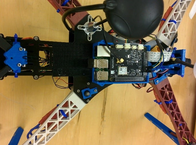
BLAZER III Pro is in the prototyping phase and will run Raspbian Linux and sensor fusion with Kalman filter for improved stabilization and localization. The drone is designed for inspecting infrastructure and carry specialized cameras. UABCL is developing computer vision algorithms with OpenCV to support control in the multirotor drone and is currently testing advanced sensor mapping using LIDAR.

Published by

anry

Arie Nakhmani joined the Department of Electrical and Computer Engineering at UAB as an assistant professor in 2013. Prior to that, he completed his postdoctoral training at Georgia Tech and Boston University. He is an Associate Scientist in the Comprehensive Cancer Center and director of the ANRY lab at UAB. He is the author of over 50 peer-reviewed research articles and book chapters on robust control, machine learning, signal and image analysis.

Leave a Reply

Your email address will not be published. Required fields are marked *